March 29, 2023
AI for Sustainable Development Goals initiative yields user-focused solutions to enhance food security


The EO & AI for SDGs Innovation Initiative was set up by Φ-lab and the World Food Programme (WFP) Innovation Accelerator to find commercially viable Earth observation and Artificial Intelligence-based solutions to global hunger issues. Launched in 2021, the initiative short-listed four start-ups and then supported them in designing and testing their solutions with users and WFP stakeholders in several countries.
Earth observation (EO) and artificial intelligence (AI) have a significant role to play in helping to increase food security. The focus of ESA Φ-lab in its research and co-funding support is always on innovation led by market and user needs, with particular emphasis on integrating emerging technologies such as quantum computing, blockchain and crowdsourcing.
These principles were very much to the fore when Φ-lab and WFP launched the EO & AI for SDGs Innovation Initiative. In selecting the finalists from the pool of entrants in the challenge, the panel sought commercially oriented start-ups with solutions which could scale up and were sustainable. WFP country offices and programme units were also consulted to gain user input.
As a result of the selection process, four start-ups were identified, all of which were deemed to have the right combination of technical prowess, flexibility and readiness for coaching. All four then attended a four-day workshop where they worked with Φ-lab and WFP stakeholders on initial co-design and piloting plans, before going off to develop their solutions in detail using the human-centred design approach.
With the initiative completed, now is a good time to look back over the progress and achievements of each project.
IBISA: forecast index insurance
Luxembourg start-up IBISA worked with the WFP Guatemala Country Office to design and test a new forecast index insurance product for smallholder farmers in the country’s Chiquimula region. The pioneering IBISA insurance model triggers action based on climate forecasts and observations, granting farmers advance pay-outs ahead of a forecast period of consecutive lack-of-rainfall or dry days. In this way the smallholders can take action to prepare and protect the harvest from damage.
The product is based on a combination of the ECMWF ERA5 dataset, 10-day forecast data and field visits, with pricing ensuring that policies are affordable for local people. IBISA and WFP are currently working together to engage local governments and communities, and product launch is expected later this year.
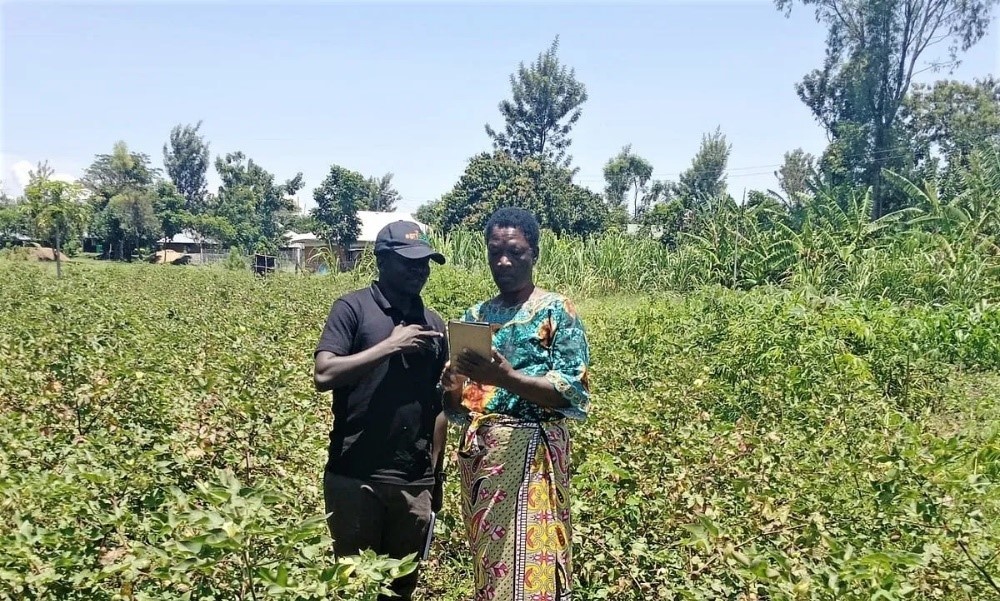
agriBORA: crop yield prediction and monitoring
agriBORA is a German company with operations in Kenya. Its platform uses machine-learning (ML) processing of satellite and ground-based data to monitor and forecast crop yields for Farmer Service Centres (FSCs), which provide information, finance and market connections to help farmers move from small-scale to commercial production. Within months of launching the pilot, agriBORA had enlisted 30 FSCs and thousands of farmers, leading to the development of models for both yield prediction and crop classification.
The pilot highlighted the fact that user geo-tagging is an essential factor for training the ML model and thereby increasing prediction accuracy. In terms of further development of the platform, agriBORA is therefore seeking to incentivise FSCs and individual farmers to geo-tag their land so that the precision of the insights they receive back from agriBORA continues to improve.
Oxford Earth Observation Limited: hydrological drought index
Specialising in water management, Oxford Earth Observation is a British start-up that has developed a hydrological drought index based on precipitation, soil moisture and surface water availability. Rather than simply relying on rainfall like the Standard Precipitation Index, the company’s more comprehensive model factors in additional components such as water run-off and infiltration to groundwater, in order to give a more complete picture of green vegetation growth.
In trials in Mozambique and Zimbabwe, Oxford Earth Observation and WFP found that growth forecasting improved by an average of 20% compared with the Standard Precipitation Index. WFP is now planning further validation of the new model and a wider roll-out in drought-prone areas.
RAMANI: CHEETAH
Highway tolls, customs charges and bribes can severely eat into the profits of players in the food supply chain, while poor road quality can destroy crops due to excessive vibration. Dutch company RAMANI has produced an application dubbed Chains of Human Intelligence Towards Efficiency and Equity in Agro-food Trade along the Trans-Africa Highway (CHEETAH). Piloted with sellers, traders and transporters in Ghana and Burkina Faso, the CHEETAH application collected crowdsourced data on charges and measured road conditions through both very high resolution optical satellite imagery and the motion sensor of users’ phones.
The result was a wealth of information that helps to monitor unforeseen costs and protect produce in transit. Possible future expansions of the application include a digital marketplace for crops, access to emergency vehicle repair and measuring CO2 savings.
“Collaborating with WFP Innovation Accelerator on this initiative has been a fantastic opportunity to see the real-world needs of growers and traders in often challenging regions,” commented Φ-lab data scientist Nicolas Longépé. “As shown by the skills and output of the four finalists, AI-powered Earth observation can be a vital tool for humanitarian development, and ultimately the final proof of the benefits is in the ability to improve lives and outcomes in communities around the world.”
To know more: Fighting hunger from space, WFP Innovation Accelerator
Image courtesy of agriBORA