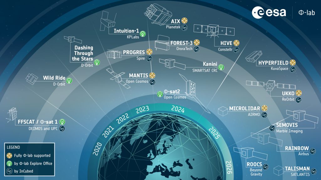
Φsat-2, ESA’s recent venture to advance Earth observation (EO) capabilities through AI on edge, was launched on a Space X Falcon 9 rocket from the Vanderberg Space Force Base in California, USA, on 16 August 2024. As part of the Transporter 11 rideshare mission, Φsat-2 will perform several AI-powered tasks on-board, generating actionable insight from raw data directly on the satellite, and improving autonomy and near real-time decision making. Also, Kanyini, from SmartSat CRC (Australia), has been successfully launched. Other three Φ-lab-supported satellites will follow in November 2024 on Transporter 12.
AI has a proven track record in the analysis of big volumes of satellite data, with most of the processing taking place on the ground after the data has been downloaded. Following the ‘AI-success’ of Φsat-1, launched in 2020, the Φsat-2 mission stands out from more traditional methods of analysing EO data, allowing direct processing at the very source: on-board of the satellite.
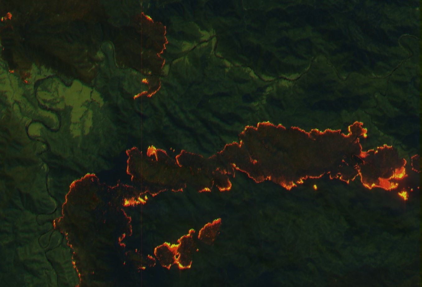
How is this possible? Φsat-2 is a 22x10x33 cm CubeSat, designed and developed by Open Cosmos as the prime contractor for ESA, and equipped with a novel multispectral camera and a powerful AI-based edge computer that will analyse and process EO imagery while in orbit. Φsat-2 has six applications running on-board, which will be used for cloud detection, street map generation, maritime vessel detection, on-board image compression and reconstruction, marine anomaly detection and wildfire detection.
The two latter applications, which concern marine anomaly detection and wildfire detection, were the winners of ESA’s OrbitalAI Challenge, coordinated by Nicolas Longépé, EO Data Scientist at Φ-lab. These two applications were developed by IRT Saint Exupéry Technical Research and by Thales Alenia Space, respectively. The remaining applications were developed and supported by an industrial consortium including CGI, Simera, Ubotica, CEiiA, GEO-K and KP Labs.
Φsat-2 will showcase the potential of developing, installing and operate custom AI apps on the satellite while it is in space. Its adaptability allows a better response to evolving needs, maximising its value for scientists, businesses and governments. Alongside Φsat-2 and other 114 Cubesats and Smallsats, the Kanyini satellite was also launched during the Transporter 11 mission. Developed by SmartSat CRC, Myriota and Inovor Technologies, Kanyini is the first South Australia government-funded satellite that will deliver critical sustainability and climate data to various institutions, detect bushfires faster than traditional methods, incorporate predictive AI for landslides and flooding, and sense urban heat islands.
To accomplish this, Kanyini resorts to two different payloads. First, the HyperScout 2 hyperspectral imager from Cosine (NL), which will provide detailed EO imagery to support crop health, forestry and inland and coastal water management research. Second, a Myriota IoT Space Services device that will enable the data transfer ability on the satellite.
The development of the Kanyini mission also counted with ESA Φ-lab’s expertise and support, including an exchange programme at the SmartSat CRC premises in Adelaide, Australia, (i.e., with Roberto Del Prete, a Visiting Researcher at the time and now Research Fellow at Φ-lab) for the creation of a set of comprehensive documentation to help SmartSat CRC partners understand data products and derivatives from Level 0 data. Roberto further examined quality control issues within data processing sequences, and together with the Kanyini team developed software for executing on-board AI based on Φsat-2 and other CubeSat standards.
Φ-lab will see soon (in November 2024, date yet to be confirmed) the launch of other three EO satellites, on Transporter 12, whose development was fully supported by the ESA InCubed programme, managed by ESA Φ-lab. The three satellites are HiVE from Constellr (DE) and OHB (DE), Forest 3 from OroraTech (DE), and a precursor of AIX from Planetek (IT), AIKO (IT) and D-Orbit (IT). This will bring the count of ‘Φ-lab-powered’ satellites and constellations to 11 by the end of 2024.
More information about the launch of these satellites can be found here and here. You can watch the full SpaceX Transporter 11 mission launch here.
To know more: Φsat-2, Kanyini, SpaceX Transporter 11 mission
Photo courtesy of SpaceX