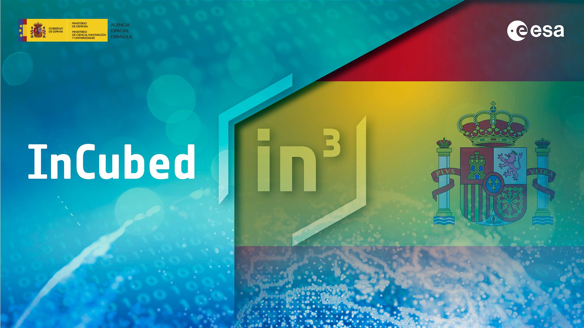
The joint ESA InCubed/UKSA funding call has awarded over £ 2.5 million to five projects that will turn Earth Observation data into essential public services. The funding supports projects tackling national priorities: CORE for safer infrastructure monitoring, GHGSat’s platform for tracking methane emissions, and three systems – THICKET, FANTOM and EO4Biodiversity – designed to support sustainable land management and enhance biodiversity.
The European Space Agency (ESA) and the UK Space Agency (UKSA) have announced the results of their joint InCubed funding call, awarding over £ 2.5 million to five innovative projects that use satellite data to improve public services.
This initiative is a clear example of how the ESA InCubed programme supports its member states’ governments in the development of a domestic space industry that serves public good. The call’s explicit requirement for proposals to target a public sector end-user shows that ESA is actively steering its investment towards applications that can directly benefit citizens and government operations.
After a very successful and fierce competition, here are the new five ESA InCubed/UKSA-funded projects:
CORE: satellite insights for infrastructure safety
Corner Reflector Enabled Remote sensing (CORE), developed by Geospatial Ventures Limited and Bloc Digital, is a solution for monitoring public infrastructure and ground stability.
Traditional surveying methods are often costly, slow, and pose a risk to personnel, especially when inspecting large building complexes or difficult-to-access terrain. CORE addresses these challenges by combining multiple satellite data streams – from Interferometric Synthetic Aperture Radar (InSAR) and high-resolution optical imagery – to detect small movements, providing a much clearer, more comprehensive view of conditions across urban and rural landscapes than single-source systems.
CORE will translate complex satellite data into actionable intelligence for public sector users, such as engineers, urban planners, and environmental managers. By integrating satellite data with artificial intelligence and machine learning, the system provides early warning of ground shifts, structural settlement, or degradation before issues escalate into dangerous or expensive failures.
“Through CORE, we’re demonstrating how Earth observation—InSAR and optical—can deliver valuable and practical benefits for stakeholders by providing early insights into environmental change, ground stability, and asset condition. ESA’s support through InCubed is essential in helping us accelerate development, integrate advanced EO capabilities, and transform satellite intelligence into actionable information that helps organisations manage risk, reduce maintenance costs, and strengthen environmental resilience,” stated Paul Bhatia, Managing Director at Geospatial Ventures Ltd.
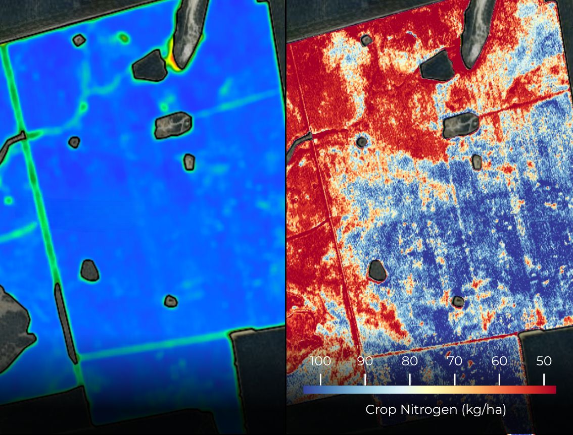
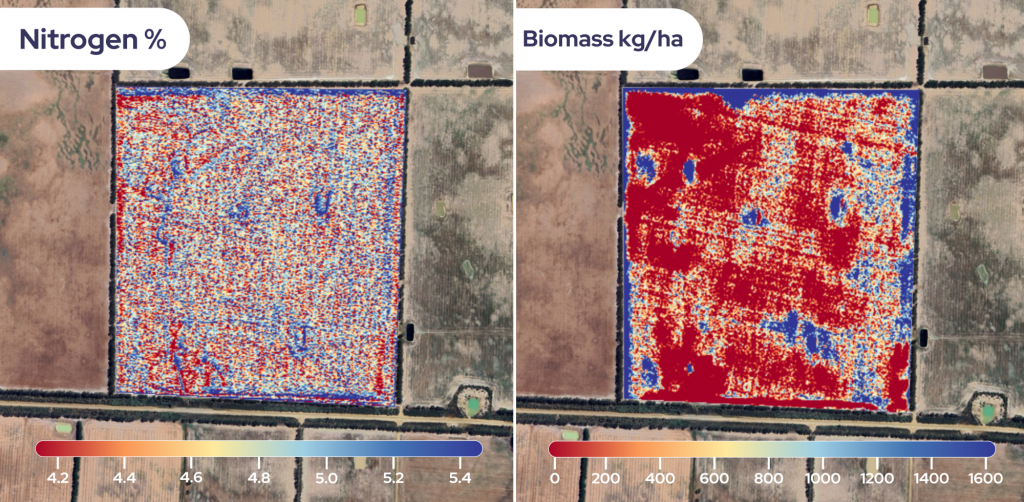
THICKET: a biodiversity mapping tool to support sustainable agriculture
THICKET is a tool being developed by AAC Clyde Space to help farmers enhance sustainability and better support wildlife on their lands.
The system will use the upcoming VIREON constellation of satellites, which will capture frequent, high-resolution multispectral images – with a detailed 1.5-meter resolution – to map habitats across farmlands. This constellation was engineered to provide well-aligned Earth observation data, including spectral bands that align with Sentinel-2 bands, complementing existing initiatives like Copernicus.
By showing farmers what biodiversity assets they have, THICKET provides the data for them to make informed, sustainable farming decisions. This capability is crucial for supporting environmental management and directly helps farmers meet the requirements to access valuable government support programmes like the Sustainable Farming Incentive.
“The ESA InCubed/UKSA co-funding has been instrumental in accelerating the development of THICKET. By combining advanced satellite technology with AI, we are creating a scalable, cost-effective way to monitor biodiversity across farmland. With imagery from our upcoming VIREON constellation, we can now capture fine details like hedgerows and flower margins — features that were previously almost impossible to assess systematically. This collaboration is helping to make biodiversity visible, measurable and actionable, supporting both farmers and the UK’s broader sustainability goals,” commented Pamela Smith, Director of Government Programmes at AAC Clyde Space.
Government GHG Service: tracking methane for net-zero
GHGSat UK and Terrabotics are developing an advanced analytics platform, Emissions Watch Service, to convert satellite observations of greenhouse gases (GHGs) into practical, actionable insights for the government. This service is uniquely positioned to support the UK’s goals of reaching net-zero emissions by 2050. By using their proprietary constellation of satellites, GHGSat traces the source of GHG emissions directly to specific industrial facilities, with a focus on the powerful GHG methane.
The platform enriches raw satellite data with detailed industrial asset information, creating a robust tool for environment compliance and reporting. Its rapid detection capability will ensure accurate data is available within hours of an emission event, allowing the UK government to make informed decisions about targeted mitigation strategies and increase accountability across major emitting organisations.
“ESA InCubed is a powerful programme, harnessing the innovation of space-based technologies for government agencies in the UK and Europe. For GHGSat, the support from InCubed is critical in order to de-risk product development while leveraging ESA’s technical expertise, enabling us to develop a platform that is honed to solve the unique challenges that government faces,” commented Daniel Wicks, Managing Director at GHGSat UK.
“Ultimately, through InCubed, GHGSat will strengthen its analytics prowess, identifying and mapping sources of methane to create a comprehensive view of emissions to inform data-backed policy, strengthen regulatory compliance, and drive methane reduction,” Daniel added.
FANTOM: advanced environmental analytics for land management
FANTOM (Future Analytics for Nature Through Observation and Modelling) is a project from Earth-i and Specto Natura designed to transform environmental land monitoring across the UK. It builds a database of agricultural and biodiversity markers, creating novel environmental indicators directly from satellite imagery.
FANTOM’s scope will extend well beyond agricultural subsidies: the platform is designed to provide content and context that supports not only agricultural schemes but also net zero and broader climate change mitigation activities. The comprehensive database of markers and impact assessments will be made available to all governmental agencies, associated arms-length bodies and commercial companies, enabling them to monitor and measure the progress of their sustainability activities and interventions.
“Earth-i’s FANTOM project, supported by the InCubed programme, will build a high spatial and temporal resolution, UK-centric database of agricultural and biodiversity markers with rich information content,” comments Jennifer King, Project Manager at Earth-i.
“This will support environmental schemes aligned with the UK’s Agricultural Transition and assist government policy implementations for Net Zero and biodiversity net gain. FANTOM will provide analytics directly to the Rural Payments Agency, which manages farming subsidies and environmental schemes for England. Following this, Earth-i aims to promote the service to other countries, tailoring the analytics products as necessary,” Jennifer added.
EO4Biodiversity: satellite tracking for habitat net gain
EO4Biodiversity is an innovative project led by HR Wallingford to leverage satellite data to improve plant and animal diversity. The project’s aim is to automate biodiversity impact assessments by developing new ways of using Earth observation data to track habitat changes over time.
EO4Biodiversity will streamline the assessment process for land development and environmental management by post-processing existing Earth observation datasets, such as the ones from ESA WorldCover, specifically for biodiversity evaluations. By automating complex assessments, this initiative moves beyond manual surveying, providing public entities and other stakeholders with a powerful and scalable service to inform planning decisions, ensure compliance, and strategically support the long-term sustainability of the UK’s natural environment.
“EO4Biodiversity is a UK-wide project that uses satellite data to improve how we measure the impact of infrastructure projects on nature. With support from InCubed, the team is developing a new tool that will help landowners, developers, and public organisations understand how different building plans affect local biodiversity. This will make it easier to protect and enhance natural habitats while meeting the UK government’s biodiversity net gain targets,” stated Marta Roca Collell, Principal Engineer, Flood and Water Management, HR Wallingford.
The campaign manager, Pejman Nejadi (End-to-end Systems Engineer at the ESA Φ-lab Invest Office), commented: “This campaign stands as a clear demonstration of the value that ESA’s InCubed programme can deliver in partnership with national agencies. By combining ESA’s unique technical expertise and programme management experience, with UKSA’s strong understanding of national priorities, we created an initiative that directly addressed the UK public sector’s need of Earth Observation data. The success of this campaign highlights both the strength of our collaboration and the effectiveness of InCubed in fostering solutions that bring real benefit to society.”
To know more: ESA InCubed, Geospatial Ventures Limited, Bloc Digital, AAC Clyde Space, GHGSat UK, Terrabotics, Earth-i, Specto Natura, HR Wallingford
Photo courtesy of Unsplash/Paul Fiedler