ESA title

Φ-week 2021 – Save the Date

The European Space Agency is organising the fourth edition of Φ-week on 11–15 October 2021. This year main theme will be the Earth Observation New Space economy and its associated innovations. The event will be virtual and free-to-attend for the public and in person for the invited speakers. The calls for proposals for Side Events, e-Posters and the e-Exhibition are already opened.

The fourth edition of ESA Φ-week will be organised virtually from 11 to 15 October 2021 and in person for invited speakers, COVID permitting. As in the past editions, this event will focus on how to accelerate the future of Earth Observation (EO), on presenting recent developments in EO Open Science and latest trends in EO markets, on exploring bold and transformative ideas that ESA’s Φ-lab and Data Applications Division support and scale up along with researchers, start-up’s, industry and private investors.

The main theme of Φ-week 2021 is the New Space economy and associated innovations. The sessions, posters and side-events will highlight how the New Space economy is developing in Europe and alongside competition worldwide, and how it contributes to the EU Green Deal, Digital Europe Programme, Destination Earth initiative, UN SDGs, and in general to the EU Space Strategy and the European space sector.

EO New Space is indeed a global trend of emerging investment and entrepreneurial philosophy that, together with key technological advancements, is enabling a private space industry largely driven by commercial motivations and will eventually evolve into EO Commercial Space. This trend is transforming several space economy sectors, for example providing small and recoverable launchers making space more accessible, delivering rich and affordable information from space, and providing internet access worldwide based on satellite constellations.

Φ-week will include inspiring talks, key sessions, roundtables, side events and other initiatives that aim to connect a multi-disciplinary community, including EO downstream and upstream world market leaders, researchers, Earth scientists, non-space companies, technology leaders, entrepreneurs, start-up’s and innovators, New Space operators, private investors, ICT players, ESA, Member States and EC representatives.

The calls for proposals for Side Events, e-Posters and the e-Exhibition are opened until 31 May and available here.

The detailed programme and all relevant information and updates will be published in the coming days on the official website: phiweek.esa.int/

Stay tuned!


Useful links: Φ-week 2021 website, Relive Φ-week 2020

AI4EO launches its first Challenge to improve Air Quality & Health

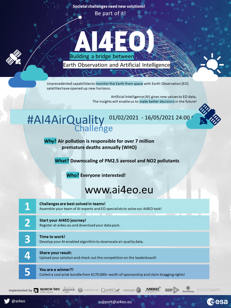
AI4EO is an ESA initiative from the Φ-lab that aims to bring together the worlds of Artificial Intelligence (AI) and Earth Observation (EO) to foster interaction and collaboration. The initiative will include various Earth Observation challenges, created by the Φ-lab, to address important issues using AI and adopt the best solutions. Register for the first AI4EO Challenge on Air Quality and Health now.

AI4EO aims to act as a bridge between EO and AI. The initiative achieves this through various challenges, an ambitious and wide-ranging community, social media, and networking campaign. This ensures the long-term future of the initiative, and encourages interaction between EO and AI to solve important issues.

The AI4EO Project Team is currently organising several thematic Challenges where participants will be called upon to find solutions to important issues using AI on EO data.

The first AI4EO challenge, the Air Quality and Health Challenge, emerges from the need expressed by ECMWF and the Copernicus Atmosphere Monitoring Service (CAMS) for higher spatial resolution of air quality data and products, using EO data from Copernicus Sentinel-5P with AI technologies.

Better information about air pollution and reducing emissions of key pollutants such as fine particulate matter and nitrogen dioxide could save millions of lives. The objective of this challenge is to downscale air quality products such as Particulate Matter (PM2.5) and Nitrogen Dioxide (NO2) to a resolution that can be used on a local level. Participants will produce AI-powered downscaling methods on three areas of interest: North Italy, California and South Africa. The most successful methods could be considered for benchmarking current methodologies. 

Participants will work in teams to address the AI4EO challenges and four winning teams, including a student team, will be awarded ‘’AI4EO points’’ to spend on various prizes provided by sponsors and implementation partners. The challenge was launched at the beginning of February 2021 and will remain open until 15 May 2021. Anyone with an interest in AI and EO can register for the challenge and join a team. More information on the Challenge can be found here.

More information on AI4EO can be found here.


To know more: AI4EO, Air Quality and Health Challenge, ECMWF, CAMS

Register for ESA’s Very High resolution Radar & Optical Data Assessment workshop

ESA’s Very High resolution Radar & Optical Data Assessment (VH-RODA) 2021 workshop will take place virtually on 20-23 April. The workshop will provide a virtual open forum (NewSpace, commercial and institutional) for the presentation and discussion of current status and future developments related to the calibration and validation of spaceborne very high-resolution SAR and optical sensors and data products. Register here for free by Thursday 15 April 2021.

There is a growing number of public and commercial providers of high spatial resolution (i.e. below 10 metres) spaceborne Earth Observation data. Key to using data from these new sources is a good understanding of their characteristics, how they are calibrated, and their quality and technical capabilities.

The VH-RODA 2021 workshop will address the quality and capability of very high spatial resolution SAR and optical instruments from public and commercial spaceborne imaging platforms. The workshop will focus on the continuative comparison and dialogue between the SAR and optical communities, institutional and commercial communities. It will also focus on the methodologies related to data quality and products validation, instrument calibration and characterisation strategies, as well as applications of Artificial Intelligence for calibration/validation and data processing, ground-based infrastructures, and calibration networks.

This workshop is planned as a technical forum for discussing spaceborne imaging systems and the data quality, calibration and product validation challenges they face. It will also provide an opportunity for the knowledge exchange among highly specialised entities, ranging from satellite operators to instrument technical teams and product validation institutions.

The VH-RODA workshop is part of ESA’s continuing commitment to spaceborne imaging technology as an important tool in providing information to address critical science and societal matters.

Workshop topics will include:

  • Calibration techniques (requirements, definitions, database, methodologies)
  • Calibration sites and techniques (cross-calibration/validation, intercalibration, field campaigns, Fiducial Reference Measurements)
  • Analysis-ready data, Digital Elevation Models (DEM)
  • Calibration of future missions and in particular of innovative concepts
  • Quality control, best practice, product validation
  • Processing and algorithms (including Artificial Intelligence for Calibration/Validation)

More information, including registration by 15 April and an agenda, can be found here.


To know more: VH-RODA 2021 workshop, registration and agenda

Space App Camp 2020 goes digital

The first digital edition of ESA’s Space App Camp was held in September 2020.  With the support of experts from the sectors of Earth observation, artificial intelligence and business, 20 app developers from eight European countries were asked to devise an innovative app using Earth observation data in one of five subject areas: smart green cities, food security, health, tourism and coastal monitoring. In this short video, participants talk about their experience, what they learnt and what they hoped to achieve.

Φ-week 2020

Replay the livestream of ESA’s ɸ-week, which brought together leading scientists and entrepreneurs from all over the world to discuss and brainstorm scientific and technological opportunities brought by the concept of Digital Twin Earth.

Over the course of the past three days, more than 1900 people virtually attended ɸ-week 2020 and participated in over 800 meetings online discussing how Earth observation data, along with in situ measurements, advanced models and artificial intelligence, can contribute to the concept of Digital Twin Earth – an interactive digital replica of our planet.

The event kicked off with an exciting announcement from ESA’s Director of Earth Observation Programmes, Josef Aschbacher, on quantum computing, updates on the ɸ-sat-1 mission and inspiring statements from ECMWF’S Director General, Florence Rabier, European Commission’s Deputy Director General for Defence Industry and Space, Pierre Delsaux, as well as Director General of DG CONNECT at the European Commission, Roberto Viola.

To know more: https://www.esa.int/Applications/Observing_the_Earth/Relive_Ph-week_2020

Watch the video on YouTube

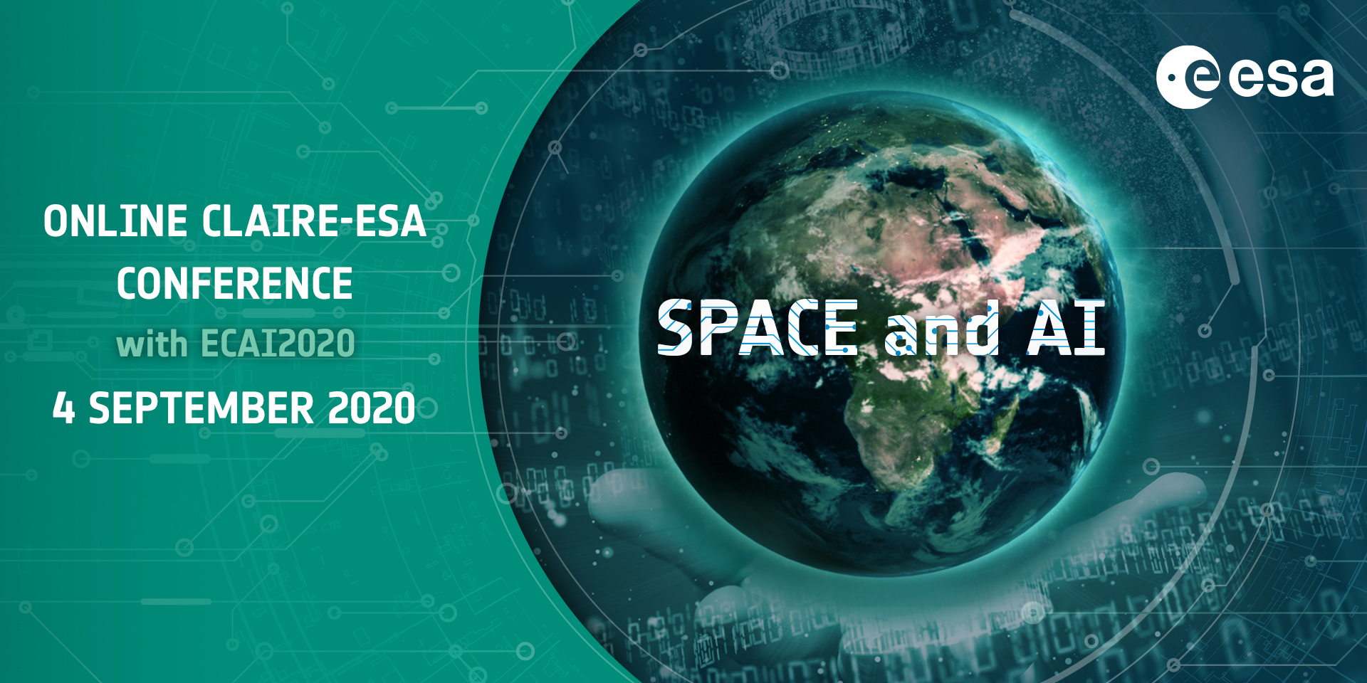
ESA-CLAIRE conference: Space and AI

Call for contributions: Online conference “Space and AI”, September 4 
(with ECAI2020)

The ESA-CLAIRE Special Interest Group is organizing its first online 
conference on the use of artificial intelligence (AI) for applications 
in space technology. We are inviting presentations on topics concerning 
different AI methods (including, but not limited to, e.g., planning, 
machine learning) and different areas of space technology (including, 
but not limited to, e.g., space operations, earth observation).

Please send to spaceandai@uni.lu before July 31 an email containing the:

  • names and affiliations of authors
  • designated speaker
  • the title of your talk
  • a 200 word abstract
  • the desired length of your presentation (10 or 20 minutes including 
    questions)

Presentations of original unpublished work or of recently published work 
are both welcome. In the latter case, please include a reference to and 
a copy of the relevant publication.

Massive Open Online Course (MOOC) on Disruptive Tech

The Earth Observation – Disruptive Technology and New Space (imperativemoocs.com/courses/disruptingeo) is a mini MOOC from ESA. It consists of a series of interviews with leading experts across Earth Observation and related technologies. The explosion in EO data from the Sentinel programme, a new generation of commercial satellites, and emerging constellations of small-sats, has created one of the greatest “big data” challenges in the world today. This course explores technologies such as AI, 3D data visualisation, cloud computing technologies and blockchain, and how they are meeting the needs of the ever-growing data analytics and data navigation challenges in EO.

The course is composed of four modules: 1) AI, Big Data Analytics and Data Visualisation, 2) The New “Internet of Data”, 3) EO – What comes next… and 4) Responding to Digital Trends.

Watch the video here: https://www.imperativemoocs.com/courses/disruptingeo

Survey on software engineering best practices for Machine Learning

Join this online survey to measure the adoption of software engineering practices by teams that develop applications with machine learning components.

Please take the 7-minute survey.

Personal information will not be collected. All answers are processed confidentially.

The survey was built by engaging with practitioners and identifying recommended practices in relevant literature. Based on this information, you can also visit this list with interesting articles, blogs, whitepapers, and tools that resulted from it.

If you have questions about the survey, or you would like to share feedback on the survey with us after you have taken it, use this e-mail.

ECMWF-ESA workshop on Machine Learning for Earth system observation and prediction

ECMWF | Reading | 5-8 October 2020

Workshop motivation and description

Machine Learning/Deep Learning (ML/DL) techniques have made remarkable advances in recent years in a large and ever-growing number of disparate application areas, e.g. natural language processing, computer vision, autonomous vehicles, healthcare, finance and many others. These advances have been driven by the huge increase in available data, the increase in computing power and the emergence of more effective and efficient algorithms.

Earth System Observation and Prediction (ESOP) have arguably been latecomers to the ML/DL party, but interest is rapidly growing, and innovative applications of ML/DL tools are also becoming increasingly common in ESOP.

The interest of ESOP scientists in ML/DL techniques stems from different perspectives. From the observation side, the current and future availability of satellite-based Earth System measurements at high temporal and spatial resolutions and the emergence of entirely new observing systems made possible by ubiquitous internet connectivity (so called “Internet Of Things”) pose new challenges to established processing techniques and ultimately to our ability to make effective use of these new sources of information. ML/DL tools can potentially be useful to overcome some of these problems, for example in the areas of observation quality control, observation bias correction and the development of efficient observation operators and observation-based retrievals.

From a data assimilation perspective, ML/DL approaches are interesting because they can be typically framed as Bayesian inference problems using a similar methodological toolbox as the one used e.g. in variational data assimilation. It can be argued that some of the techniques already common in the data assimilation community (e.g. model error estimation, model parameter estimation) are effectively a type of ML/DL. The question is then, what lessons can the ESOP community learn from the methodologies and practices of the ML/DL community? Can we seamlessly integrate these new ideas into current data assimilation practices?

ML/DL solutions are also being explored for model identification, either in terms of the full forecast model or for specific model parametrizations which are computationally expensive and/or physically uncertain. How to best combine physical knowledge with the statistical knowledge provided by ML/DL approaches is an important and open question. Various types of machine learning technologies have also a rather long history of application in model interpretation and post-processing. The question of how ML/DL can help us extract more value from environmental forecasts is thus a relevant and current one to pose.

An important issue are the uncertainty characteristics of the ML results, and to understand better what physical relations they have been trained on. Many methodologies for both uncertainty quantification and for back-tracing ML output to input features have been proposed, but there is not yet a consensus view. Progress here is needed to improve and better understand reliability of ML results, which is crucial in an operational context. 

Workshop aims

In the application of ML/DL techniques to ESOP there are still many unanswered questions. The aim of the workshop is to appraise the state of the art of the application of ML/DL techniques to ESOP, to identify the main issues that need to be solved for further progress, and to make a start on charting ways forward. Presenters of the longer talks will be expected to cover not just their own work but also to give a general overview of the subject. Discussions will be facilitated by parallel working groups where the main issues will be discussed in more detail. The output of the workshop will be in the form of working group reports, to be summarised in a technical memorandum or paper.

Registration and abstract submission

Registration for the workshop will open in April 2020.

Both oral and poster presentations are encouraged. Attendance that contributes only to the working groups and discussions is also welcome, up to available capacity.

Organising committee
  • Marc Bocquet (ENPC)
  • Massimo Bonavita (ECMWF)
  • Marcin Chrust (ECMWF)
  • Peter Dueben (ECMWF)
  • Alan Geer (ECMWF)
  • Peter Lean (ECMWF)
  • Pierre Philippe Mathieu (ESA)
  • Peter Jan van Leeuwen (Univ. of Colorado)
Confirmed invited speakers
  • V. Balaji (Princeton Univ. and Paris/IPSL)
  • Marc Bocquet (ENPC. France)
  • Alberto Carrassi (Univ. of Reading, UK)
  • David Gagne (NCAR)
  • Pierre Gentine (Columbia, NY, USA)
  • David Hall (NVIDIA)
  • Pieter Houtekamer (Environment Canada)
  • Brian Hunt (Univ. of Maryland, USA)
  • Vipin Kumar (University of Minnesota Twin Cities)
  • Peter Jan van Leeuwen (Univ. of Colorado, USA)
  • Takemasa Myoshi (RIKEN, Japan)
  • Manuel Pulido (Univ. Nacional del Nordeste, Argentina)
  • Markus Reichstein (Max Planck Institute, Jena, Germany)
  • Duncan Watson-Paris (Univ. of Oxford)

AI4EO Challenge with UNOSAT

This challenge was organised by Phi-Unet in partnership with UNOSAT a technology-intensive programme under the United Nations Institute for Training and Research. The aim of the contest, instigated by UNOSAT in partnership with RUS Copernicus and with the technical support of CERN openlab, was to put artificial intelligence and Earth Observation data at the service of a humanitarian cause: supporting the Iraqi government in planning reconstruction activities.

This challenge is focused on the creation and generation of the building footprints in Iraq. The building footprint request comes out of a need from the UN Populations Fund (UNFPA). UNFPA is the United Nations sexual and reproductive health agency. They are assisting the Government of Iraq to plan the October 2020 population census, which is crucial for key baseline information in support of reconstruction and development (i.e. fight extreme poverty, inequality and sexual and reproductive health problems, prevention of gender-based violence, climate change resilience). The building footprints are needed to plan the implementation of the on-site survey interviews – and the contest has two phases.

Satellite image of Kirkouk city in VV polarisation with model predicted binary mask, building objects vs non buildings (green contour). Credits: Andrey Malakhov and Alessandro Patruno (Team Zephyros)

Machines with 4 cores and 16 Go RAM), or use their own computing environment to develop their workflow. The second phase (still ongoing) provides VHR 3-band natural color images for three cities, plus Open Street Map (OSM) data with a total of 722,837 building polygons.

In order to process the images provided (with two polarisations – VV-VH) and to perform a semantic segmentation, some participants used a U-Net (fully convolutional network) architecture, with pre-trained VGG11 encoder or Resnet34 backbone and center dilation layer. These results have been evaluated using the F-1 score (a weighted average of the precision and recall). Phase 2 results will be released in early April.

Satellite image of Bagdad city in VV polarisation with model predicted binary mask, building objects vs non buildings (green contour). Credits: Andrey Malakhov and Alessandro Patruno (Team Zephyros)
Predictions overlaid with Bing imagery in QGIS (from top left to bottom right: Bagdad, Kirkouk, Samawah, Tikrit). Credits: Tomasz Dyczek