

The space environment is changing, and new data providers are complementing the space industry with low-cost micro-satellites with the purpose of increasing the range of available EO data. AI provides a solution for managing these increasing volumes of data in the near future.
ICEYE is a new company that is building a constellation of micro-satellites equipped with SAR. Its activities in terms of data quality and AI techniques are focused on reinforcing the synergy with ESA, increasing the collaboration and providing data validated in conformance with ESA guidelines, together with sharing data for common projects and ideas on different applications.
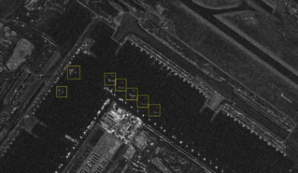
The use of AI is particularly relevant when applied to the remote sensing area. The first challenge is the exploitation of a very large amount of ICEYE X-band EO data to maximise the informative content while minimising the processing time. In this context, a dedicated dataset and the associated ground truth are to be prepared and shared with Φ-lab researchers.
The second challenge is the use of AI for onboard processing. AI-driven processing on the satellite could reduce the volume of data which is required to be downlinked in the process and could allow the onboard implementation of dedicated detection algorithms.
The above challenges are dependent on the calibration and validation process that is currently ongoing on ICEYE satellites X2, X4 and X5.
With the volume of EO data drastically increasing and the appearance of new companies with new micro-satellites, ICEYE is helping to foster the implementation of processing techniques based on AI to enable the rapid processing of large quantities of data, thus reducing unnecessary data transmission to the ground.
At the same time, it is important that each EO data provider characterises the quality of the data provided to users after the calibration and validation phase.
ICEYE activities are geared towards this direction, performing a quality assessment on the X-band SAR data and developing onboard and ground processing techniques based on AI.
In the context of data processing on ground, ICEYE will prepare a dedicated dataset with the available ground truth for land classification and maritime monitoring, using semantic segmentation with NN. The dataset will be shared with Ф-lab researchers


