
Land use classification is a critical task for agriculture monitoring. So far, most approaches based on remote sensing only exploit optical data. However, they are not always reliable as they depend heavily on cloud-free weather conditions. Radar, on the other hand, ‘sees through’ clouds, a particularly useful advantage in some areas.
Moreover, SAR captures additional information like texture or moisture, and recent missions such as Copernicus Sentinel-1 or TerraSAR-X provide high-quality observations with a high revisit frequency. This enables the study of the growth cycle of crops.
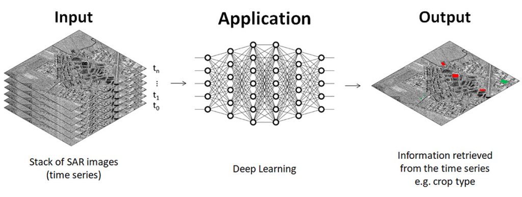
This work aims at using DL methods to analyse time series of SAR images for land cover monitoring and segmentation. The performance of different techniques is also compared, namely 2D-CNNs which consider spatial context and 3D-CNNs to capture temporal dependencies. It would also be interesting to use different SAR products and pre-processing algorithms as additional dimensions through polarimetry and interferometry.
With a dataset limited in size, spatial information alone does not seem to be sufficient for accurate classification. A 2D-CNN trained on VV and VH backscatter does not generalise well on unseen fields. To incorporate the temporal dimension, time stamps were stacked and used in a 3D-CNN.
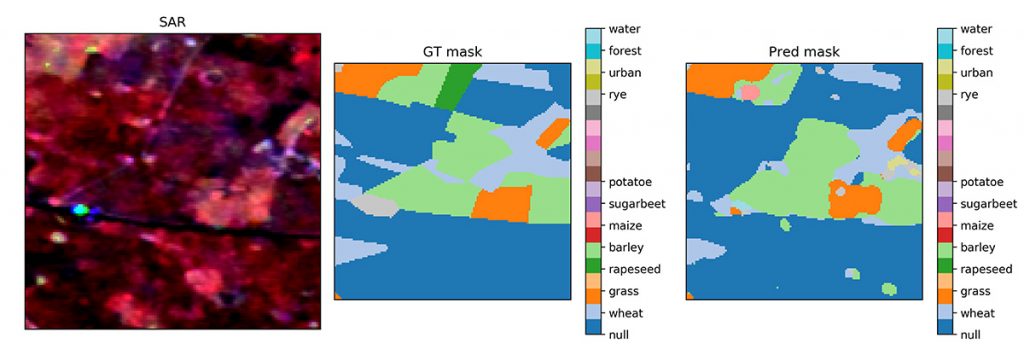
This type of network, originally developed for volumetric medical images, has also been used for hyperspectral image segmentation. This proved to yield good results for crop-type classification. The field boundary detection is also quite accurate. The performance could still be improved for underrepresented classes and small fields. The next steps include refining the model architecture and incorporating other SAR outputs such as coherence.


